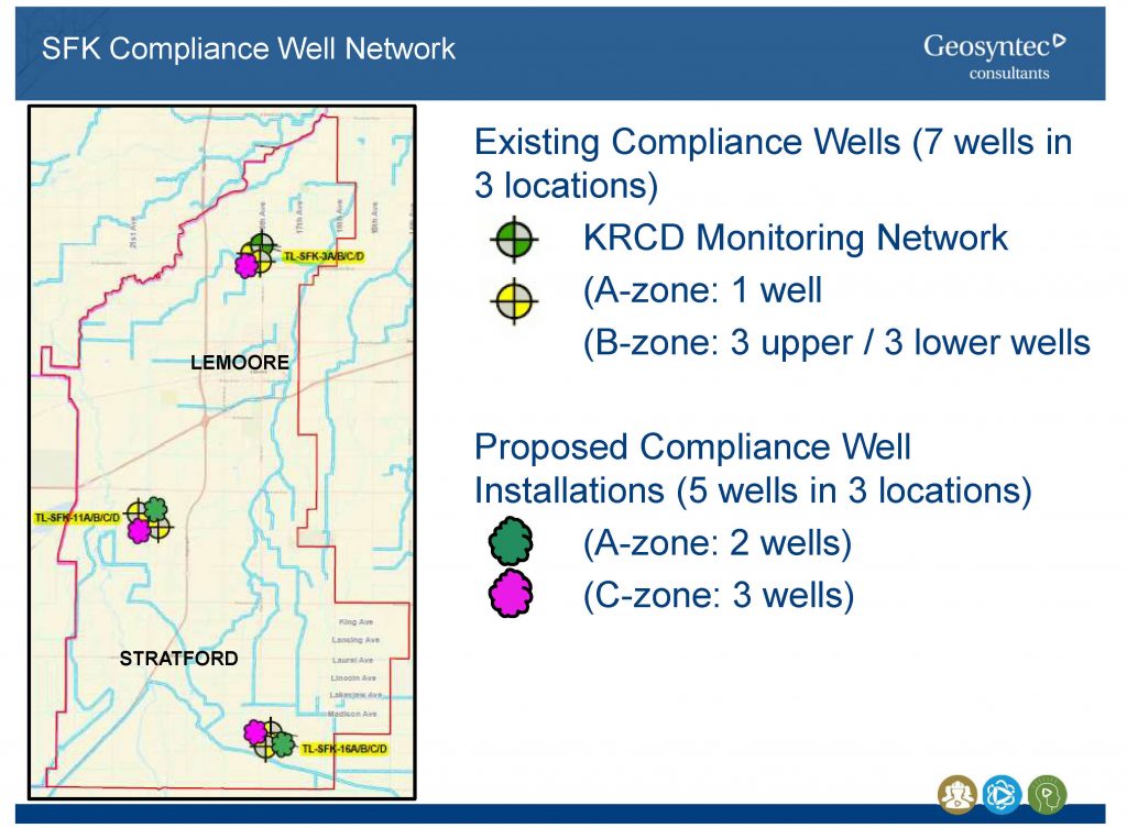
Twelve Wells will Monitor Groundwater
South Fork Kings GSA’s technical consultant, Geosyntec presented at the May 23 Board workshop the proposed well network to be included in the Groundwater Sustainability Plan. Three locations within the SFKGSA service area have been identified. The wells at these locations are where the GSA will measure water levels to report to the State Department of Water Resources.
The wells will provide data from three separate levels in the aquifer from shallow to deep: zones A, B, and C. A-zone wells are located in the shallow perched area of the aquifer within the top 100 feet above the A Clay. The B-zone wells are below the A Clay layer and above the Corcoran Clay, the deepest clay layer. It is an unsaturated aquifer so water levels go up and down. The C-zone are wells installed below the Corcoran Clay. It is a confined aquifer so there is less variation of what is occurring in the aquifer at that level.
The network will use existing wells but will also require the drilling of additional wells to ensure adequate data is collected. Currently, there are seven existing wells in the three locations that are part of the Kings River Conservation District’s monitoring network. There is one well in the A-zone and six wells in the B-zone. Five additional wells will need to be installed to complete the network, two in the A-zone and three wells in the C-zone.

