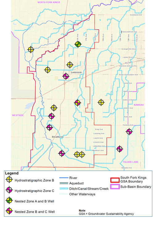
Preliminary Monitoring Network Identified
SFKGSA’s technical consultant, Geosyntec, has researched and identified wells for consideration as part of the Groundwater Sustainability Plan monitoring network. The wells will provide data from three separate levels in the aquifer, zones A, B, and C. A zone wells are located in a perched area of the aquifer within the top 100 feet above the A Clay. The B zone wells are below the A Clay layer and above the Corcoran Clay. It is an unsaturated aquifer so water levels go up and down. The C zone are wells installed below the Corcoran Clay. It is a confined aquifer so there is less variation of what is occurring in the aquifer at that level.
Additional wells will be considered for the monitoring network, and new wells may need to be installed to ensure there are no data gaps in the network. In addition, data sharing is anticipated with neighboring GSA wells along the outer boundaries of the South Fork Kings GSA area.
Monitoring Network Preliminary Wells Map

