Innovative Helicopter-Based Technology is Mapping Groundwater in the State, including over South Fork Kings GSA
South Fork Kings GSA landowners may see low-flying helicopter towing equipment over next several weeks
November 10, 2021
The California Department of Water Resources (DWR) is using an innovative, helicopter-based technology to gather information about the state’s groundwater aquifer structure to support drought response and implementation of the Sustainable Groundwater Management Act (SGMA).
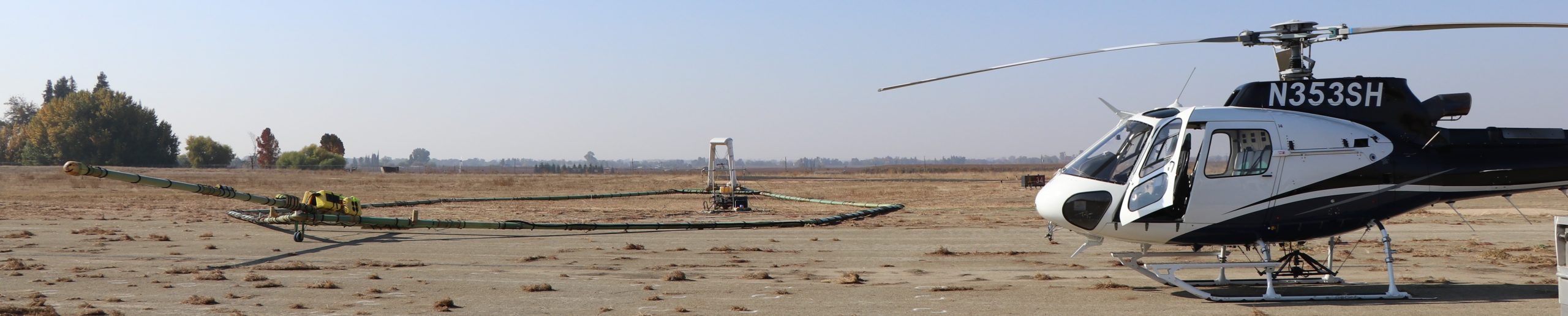
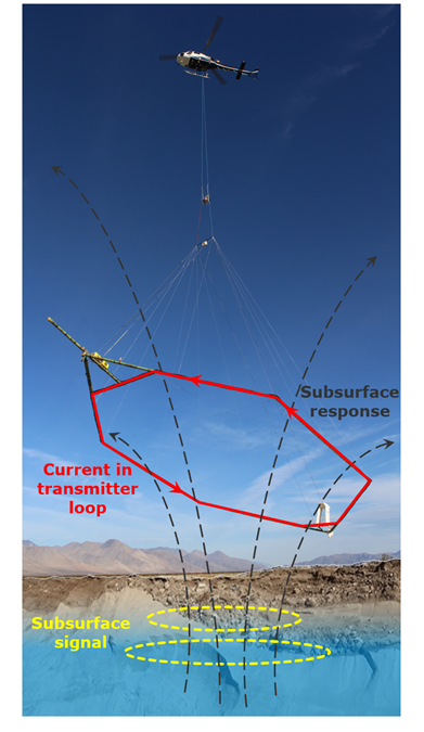
Beginning November 19, 2021, DWR will conduct airborne electromagnetic (AEM) surveys of groundwater basins in the San Joaquin Valley in Kern, Tulare, and Kings counties, specifically in White Wolf, Kern County, Tulare Lake, Tule, and Kaweah. This includes areas over the South Fork Kings GSA. Landowners may see a low-flying helicopter towing a large hoop with scientific equipment approximately 100 feet above the ground surface. The helicopter crew may run test flights several days prior to the start of the surveys as well.
The helicopter, flown by experienced and licensed pilots, will make several passes over the survey areas.
“The data collected during these surveys will provide a better understanding of California’s groundwater systems, and in turn support more informed and sustainable groundwater management and drought preparedness and response approaches,” said Steven Springhorn, DWR’s SGMA Technical Assistance Manager.
Survey data creates an image of the subsurface down to a depth of about 1,000 feet below ground surface and provides information about large-scale aquifer structures and geology. This information supports the implementation of local groundwater sustainability plans (GSPs), which help local agencies like the South Fork Kings GSA sustainably manage groundwater during drought.
The AEM method is safe, and surveys have been conducted successfully in several locations throughout California. Surveys will be conducted during daylight hours only, and the helicopter will not fly over businesses, homes, other inhabitable structures, or confined animal feeding operations. The helicopter operator follows all established Federal Aviation Administration rules and regulations and their highest priority is public safety. Experienced pilots, who are specially trained for the low-level flying required for geophysical surveys, will operate the helicopter.
For more information about the AEM surveys, visit DWR’s AEM project website. For questions, please email AEM@water.ca.gov.
For more information, watch DWR’s short 2-minute video on the AEM method, provided in both English and Spanish.