The Model, the Data and Groundwater Sustainability
At the February 1 Board meeting, South Fork Kings Groundwater Sustainability Agency (GSA) technical consultant, Bob Anderson of Geosyntec Consultants, covered what a model can and cannot do and the importance of data and how they will be used in determining groundwater sustainability in the Tulare Lake Subbasin.
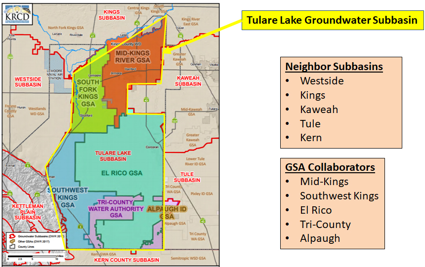
To guide regional activities necessary to implementing the Sustainable Groundwater Management Act of 2014 (SGMA), a Groundwater Sustainability Plan (GSP) will be prepared to cover the entire Tulare Lake Subbasin (see diagram below). The South Fork Kings GSA is one of six GSAs within the subbasin that must coordinate their planning to complete a shared GSP, but coordination is not limited to the six GSAs.
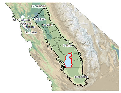
The Tulare Lake Subbasin is delineated by a political rather than scientific boundary. The geological or physical boundary of the principal aquifer, the San Joaquin Valley Basin, is bound on the east by the Sierra Nevada, to the west by the Coastal Range and north and south by Sacramento and the Tehachapi Mountains. The Tulare Lake Subbasin is 1 of 16 subbasins within very large (9-million acre/14,000 sq/mi) San Joaquin Valley Basin.
In order to understand and address water flow between political boundaries SGMA also requires that GSAs in each subbasin coordinate with GSAs in neighboring subbasins. The visual below shows the South Fork Kings GSA, the five other GSAs in the Tulare Lake Subbasin and their neighboring subbasins.
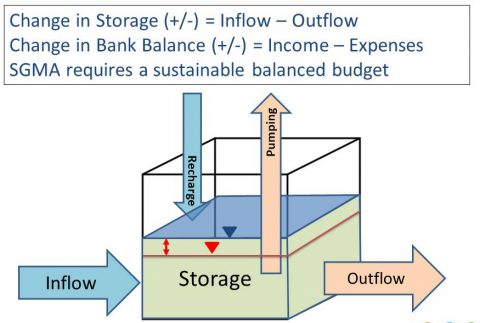
The core element for the GSP is its water budget, which describes the amount of water coming into a subbasin versus the amount going out. A good comparison for understanding how a water budget works is to think of it as a bank account. SGMA requires that a subbasin identify impacts of over-pumping and then take corrective actions that will result in long-term sustainability. It is up to the South Fork Kings GSA Board to define what “sustainable” means within its jurisdiction and in the entire Tulare Lake Subbasin through coordination with neighboring GSAs.
Water Budget Diagram
A computer model is a tool that breaks down an area into thousands of individual water balance cubes that when combined can make very complex groundwater flow and water balance calculations.
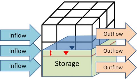
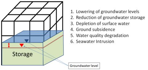
The computer model for the Tulare Lake Subbasin will assess the six undesirable results as defined by SGMA. Defining these six undesirable results for the South Fork Kings will be the roadmap to sustainability for the groundwater subbasin. The diagram below illustrates how a model computes one undesirable result, the chronic lowering of groundwater levels.
Models need data. Data is the best indication of what is going on. Where data does not exist, assumptions must be made and therefore the more data there is the better the analysis will be. Some data is already available through sources like the Department of Water Resources (DWR) that has collected depth to groundwater data for years.
Other important data needed include surface water diversions and cropping patterns. In the absence of measured groundwater well pumping rates, the Tulare Lake Subbasin model will back its way into a groundwater pumping estimate using cropping pattern data coupled with irrigation estimates and measured surface water diversions.
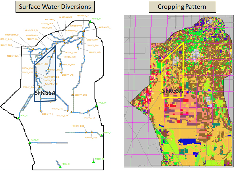
Tulare Lake Subbasin Pumping = Crop Consumptive Use–Surface Water Delivery
The model and data are a couple of the pieces needed to complete the GSP by the State’s deadline of January 2020.