Airborne Electromagnetic Survey will help South Fork Kings GSA make groundwater management decisions
The Department of Water Resources has received funding from a Proposition 68 grant to conduct Airborne Electromagnetic (AEM) Surveys throughout the state.
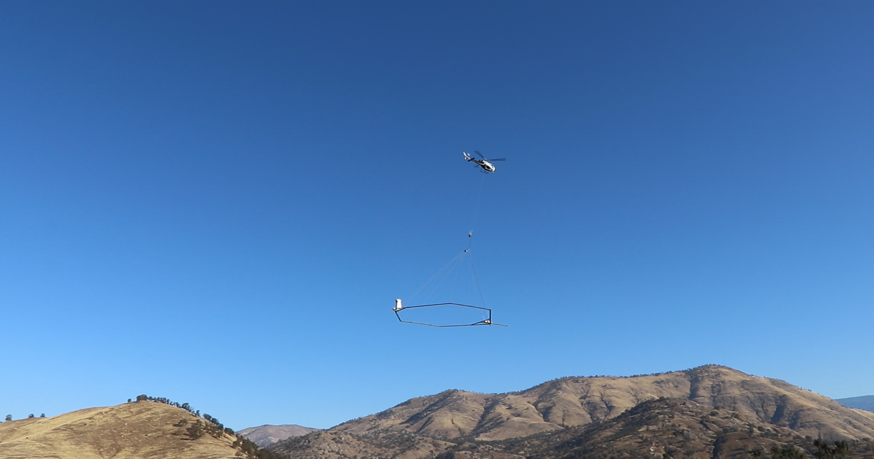
During an AEM survey, a helicopter tows electronic equipment that sends signals into the ground which bounce back. The process has been compared to taking an MRI of the ground’s subsurface. The data collected is used to create continuous images that are interpreted for underground geology. The resulting information will provide a standardized, statewide dataset that improves the understanding of aquifer structures. It can also help with the development or refinement of hydrogeologic conceptual models and can help identify areas for recharging groundwater. (DWR)
These AEM Surveys will begin in Salinas valley, then move toward the southern Central Valley and work their way north. The data collected by the AEM survey will allow South Fork GSA to make informed groundwater management decisions, like what areas of the agency are ideal for recharging groundwater during wet years. After the flight has taken place, it will take about 6 months to get the AEM results from DWR.
The success of this survey is dependent on driller logs and the collection of other pieces of data. Stanford University and Dr. Rosemary Knight, are conducting additional subsidence modeling, digitizing well driller logs and well completion reports, and are looking to utilize NASA funds for this work. SFKGSA will write a letter of support for Dr. Rosemary Knight to show NASA that there is a need and interest in the collection of this data.